3150 km, that's the distance covered in a bit more than two weeks, for this road trip I was looking forward to. After these months of being upside down between Covid and adaptation to a new country, I think I really needed a break from my life in Nelson. When I first landed in Canada I had been debating whether to move to Nelson, Squamish or the Sunshine Coast. I had also heard that Vancouver Island was beautiful but not being a big surfer I didn't look into it any further. Due to this endless pandemic and the approaching winter, I had to make a very quick choice and it was to Nelson that my heart headed to. However, the idea of discovering these regions had never left my mind all this year... And these two weeks of holidays from work were finally the opportunity for me to venture there.
Before showing you a large part of British Columbia in pictures, I thought I'd be starting by giving you 3 maps of the province and of Canada to help you understand the surface and distances covered.
The first map is the one of the Road Trip, with the 3 regions I travelled through: Vancouver Island / Sunshine Coast and the Interior region (actually Vancouver, Squamish and Whistler are not part of it, but I simplified it). In blue are the main roads used during the trip.

Second map, the road trip map compared to the size of Canada... Right away, it changes the game.

Third map: France on top of Canada... I used the site The True Size of which I think is great for playing with country sizes. British Columbia is approximately the size of France if you look at this map... The difference is that here, it's much less populated, so there are many empty stretches on the roads where we don't see anyone for a while.

Now that you have an idea of the country, the province and the regions you will be visiting, let's go on the road trip. On the menu this time : sea breeze, mountains and waves that intertwine, dreamy camping spots, yummy restaurants, mountain bike adventures, hiking and, as usual, lots of photos... So shall I take you along? Let's go!
FROM NELSON TO VANCOUVER
I was so excited to leave that the 8 hour drive to Vancouver didn't seem as long as the drive back. We passed through Osoyoos and a small part of the Okanagan Valley, where we slept for the first time in my newly converted car. It was a good opportunity to test my Coco Brico skills and to check the level of comfort that awaited us for the rest of the trip. Verdict: "not too bad, a bit hard under the mattress, but it should make it!
And then, not so bad for a first night spot with a view on this Okanagan Valley desert!
In the early morning, we hit the road again to reach the big city of Vancouver, where we were gonna meet up with one of John's friend. On the way, we had to stop to buy fresh cherries in this region, which is known to be very sunny and to have the best ones. In the end, we stayed in Vancity for dinner, eating oysters fresh from the harbour before escaping to camp near Horseshoe Bay, where our ferry would be waiting the next morning.
FERRY CROSSING : HORSESHOE BAY > NANAIMO
We woke up early because the ferry departure was at 6:30 am. As I know how timing can stress me out, we had woken up pretty early so that we would not miss the boat. But this was without taking into account the whims of the GPS, apparently not as docile as usual, having taken us to the wrong side of the gates... After a big rush of stress and an unexpected visit of all the streets of Horseshoe Bay Village, we finally reached the ticket office and boarded the boat, just in time.
Once on board, there was no way I was going to stay inside, I was far too excited to go and see the landscapes that were waiting for me! What's more, this time it was the ocean that surrounded me. And with the ocean comes the chance to see dolphins, orcas and whales from the boat. The colours of the sunrise were impressive and the silhouette of the buildings in the background quite magical. However, for the marine animals, you'll have to come back because this time, nada.
VICTORIA
Once we got our feet on the island (or wheels, actually), we drove from Nanaimo to Victoria, the capital of British Columbia, to meet up with some of John's friends for the afternoon. It was a great way to discover a city that looks very charming in the pictures, but which I must admit, in reality, left me a bit perplexed. BC is a bit of a mix of American and European style cities. The difference is that the streets of the latter don't really invite you to stroll around as you would in our beautiful old France/Europe. And that, for the Parisian that I was for a few years, I miss it a little.
FROM VICTORIA TO PORT RENFREW - WEST COAST
Since we were sleeping in Copine, we had to leave town before dark to find a place to camp. So we set off again at the end of the day, this time in the direction of Port Renfrew. An hour's drive later, we stopped by the sea for our first night, lulled by the sound of the waves. In the morning, we headed to the Shirley Delicious café, for a king's breakfast before starting the discovery of the West coast of the island !
MYSTIC BEACH
On the way to Port Renfrew, we made a first stop at Mystic Beach. I had read that it was one of the most beautiful beaches on the island with one of the most beautiful waterfalls... (in reality, it's more of a trickle than a waterfall but still nice to see). After a short walk through a magical rainforest, we reached the sea. It had only been 3 days since we left on holiday but I must admit that I already felt so relaxed after this trip... I don't know if it's the sea air that heals the souls or if it's a myth, but for me, there is definitely something magical that happens when I leave my mountains to go see the sea (and that's without mentioning the effect of the forest baths where the tops of the trees seem to touch the sky!)
SOMBRIO BEACH WATERFALL
Second stop, the hidden waterfall at Sombrio Beach. This beach is part of a hike that runs along the wilderness coast from Port Renfrew to Sooke and is therefore very popular for camping (as is Mystic Beach actually). It is a 42km multi-day hike called Juan de Fuca. Many tourists, like us, only come there for the day, just to enjoy the ocean and its landscapes.
For the record, I had found a blog post that explained how to get to the famous hidden waterfall. It said to bypass two rivers/streams and go up the second one, to reach a green canyon. The problem was that on that day, it was hard to tell the difference between a stream and a river... So here we are, following in the footsteps of other budding adventurers who, just like us, had difficulty making the difference... After 30 minutes in the mud, going up a path that was becoming more and more inaccessible, we turned back. "The hidden waterfall is surely not that way"... In the end, it was along a real big stream, only 5 minutes walk away and it wasn't so hidden as there was a queue to watch it... And yeah, that's the joys of mass tourism even in a country where there aren't many inhabitants per square kilometre.
On the way, we passed two French bulldogs sunbathing, just like my chichi would do. So we had to steal some attention from them and take a few shots that I'll share with you because they were so cute. Well, also because I miss my chichi a little bit.
PORT RENFREW
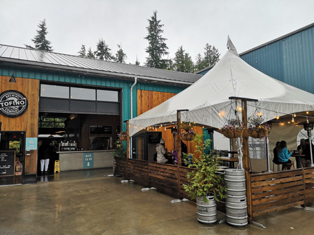
After these two adventures, it was time to go to Port Renfrew, a small fishing village, lost in the middle of nowhere. Apart from the brewery (in the sense of a beer brewery ;)) there wasn't much to do there. John being a beer lover (like many Canadians) we sat on the terrace for a pint or two, enough to decide where we would sleep.
AVATAR GROVE
By the time we left Port Renfrew it was 4.30pm. I have to admit that I really didn't want us to venture out to Avatar Grove, another rainforest with ancient trees when it was going to get dark very quickly. But we didn't have many options for camping that night, the route choices were slim and the road to Avatar Grove had several spots to camp.
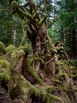
So we set off to explore this forest as it was slowly getting dark. The advantage? We had the whole park to ourselves! It was quite magical in the end and there was something very mystical and spiritual about those trees. Do you remember Grandmother Willow in Pocahontas? Well, it was a bit like that. We stayed there for 30 minutes cuddling the trees and playing with our cameras. The forest was initially pleasantly silent but once the darkness of the night set in, it was quite eerie. Usually it's my imagination that leads us to have to leave, lest some strange, wacky monster should come along. But that night, it was John who decided that we wouldn't sleep there. "That place is too creepy", he told me.
So we headed back to the road to see what we could find before deciding to turn around and head back to civilization. It was at this point that we came across a group of 3 cyclists that we had passed earlier on the road. They were pedalling at full speed, without lights, trying to get out of the forest as it was getting dark. We were quite surprised to see them again and to be honest, I was a little worried about them. After stopping to check that everything was ok, they confided that they had indeed not planned their bike ride very well and were starting to lose sight of the road, which was full of gravel and obstacles to avoid. John decided to follow them and so we played the leader, riding at 10km/h alongside them so that they could pedal in the light of our headlights. Once they reached the main road, John handed over his headlamp so they could continue on their way a little more safely and we left them (not without concern) to try and find somewhere to sleep safely too. And yeah, that's the kind of surprising stories I tell when I come back from a road trip.
For the record, there are very few hundred-year-old trees like these left in Canada (despite all the postcard images we have of them). The same story as in New Zealand (and in France, probably decades ago), forestry companies see it as a gold mine when it comes to cutting down a tree with such a large circumference... Justin Trudeau, (the Canadian Prime Minister), apparently pledged his mandate to protect these forests from Canada's all-important logging trade. But there is often a big gap between the words of politicians and their actions. So some have turned to civil disobedience... you know it? it's "Civil disobedience is the active, professed refusal of a citizen to obey certain laws, demands, orders or commands of a government, corporation or other authority. By some definitions,[specify] civil disobedience has to be nonviolent to be called "civil". Hence, civil disobedience is sometimes equated with peaceful protests or nonviolent resistance" (thank you wikipedia)
For over a year now, protesters have been gathering to build a barricade and prevent trucks from accessing several sites near a park called Fairy Creek. This has made the headlines for several months here in Canada and especially the front page of social networks to denounce the violence suffered by the demonstrators despite their passivity in front of the police. What started with a small group of people and an encampment to protect a particular site turned into a dozen encampments, gathering a hundred people and creating a movement against the massive deforestation of old growth trees in Canada.
Imagine, that was more than a year of relief, day and night, chaining themselves to trees or the ground and blocking their access to try to save them... I have to admit that, given the reports of police violence I had heard about, I was a bit afraid to go that way (as Fairy Creek was on our way). But in the end, I was relieved to see so many cars parked along the barricade, meaning that after all these intense months of fighting, there were still enough people left to continue the battle... A few weeks ago, I heard that the police troops had finally left, giving the protest crew a bit of rest... Phew...
CATHEDRAL GROVE
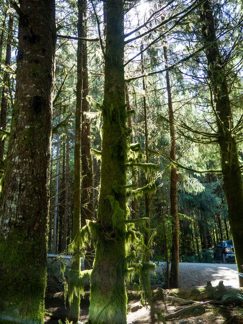
On the way to Tofino, we stopped at Cathedral Grove, another protected site with old growth trees. This one is directly accessible from the main road, making it much more famous and visited than Avatar Grove. It was another opportunity for us to walk through ferns, cedars, pines and other tall men of the forest. It's amazing how quickly this kind of scenery awakens the imagination. All that green that soothes the soul. These giants that remind us how small we are... There is nothing more healing for the soul than a walk in the forest, like this one...
Before reaching the famous Tofino, we decided to camp on the way near highway 4. Thanks to the ioverlander application we used during the whole road trip, we had found a small heavenly spot near an emerald river. To get there, we had to take a very narrow road, partly covered by tall grass and with trees forming a green arch to cross. I have to admit that I wasn't quite sure where I was taking us, but in the end it was a diamond that place. Incredible! (and then I was able to visit the Brum Bus, fulfilling one of my little dreams at the same time! and no, it didn't take the same road as us, there was in fact another access a little wider apparently!)
TOFINO
Oh Tofino... It's certainly one of the most famous places on Vancouver Island... which means it's also one of the busiest places on the island... And we really hadn't calculated our itinerary well since we were there exactly for the long weekend in September... We might as well tell you that it was like the south of France in the middle of August!
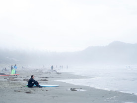
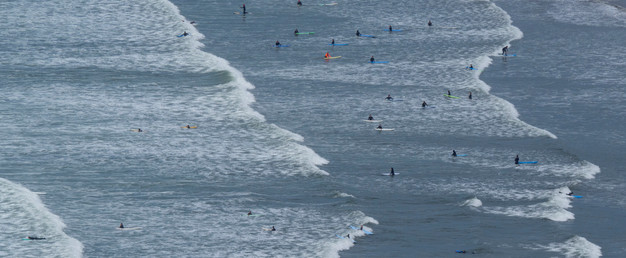
Tofino is a small seaside village with endless beaches and ideal waves for surfers. It's a view of the ocean without any other continent coming to change the horizon (something very rare in British Columbia!). There are many restaurants to tempt your taste buds and a protected nature park with hikes that take you through dunes, swamps and rainforests.
The first day, it was raining (like most of the days on that part of the island). So we had the same idea as everyone else and went to the shops... As for the restaurant, we had to wait 1h45... So we decided to try the brewery just to wait. But there too, 45 minutes of waiting... It was crazy... The next day, the weather was a bit nicer. So we embarked on some micro-adventures and had lunch at Tacofino, the famous taco and burrito food truck. Once again, 1h20 of waiting later, we held the grail in our hands... Ah Tofino, once, but maybe not twice...
UCLUELET
Ucluelet is this other little village near Tofino, where the scenery definitely reminded me of our french brittany coastline. Since it was too rainy for big adventures, we went for a walk on the Ucluelet lighthouse loop, a path along the coast. It was a bit wet, but it was a good opportunity to get some fresh air before taking the most expensive shower of our whole road trip. 7 Dollars for a not so clean shower. Hmmmm I was delighted.
TOFINO PLANE CRASH
First adventure in this part of the island: a hike to discover an abandoned plane carcass, not far from the airfield. Luckily, the national park employees have recently "renovated" the path, making it much more passable than I had read. Between rainforest and swamp, this adventure had a reputation for being very muddy.
In 1941, after the Pearl Harbour incident, the Canadians decided to set up a military air base in Tofino. On February 10, 1945, after a night take-off, the plane's engine failed, causing it to crash. On board were 12 passengers, numerous bombs and munitions, and a full tank of fuel... After the impact, the fuel spilled onto the ground and the wreckage burst into flames. Since the passengers could not reach the radio tower and could not send distress rockets because of the risk of explosion, they took refuge several metres away, creating a shelter with the parachutes they had. The next morning they decided to send a distress signal to an aircraft that was passing overhead. The latter responded by sending another distress flare, which luckily did not land on the petrol-soaked ground... 11 hours after the crash, the whole team was saved, the bombs defused and the wreckage abandoned on the spot.
A trip between nature and history, to delight young and old!
COX BAY
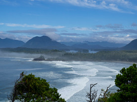
Last exploration before leaving Tofino, direction Cox Bay, for THE postcard view I was looking for. In fact, the problem with Tofino is that you don't really realize how incredible the surrounding landscapes are when you are at sea level. The only way is to get to the top. Cox Bay was the perfect hike for that, and I finally understood why so many people fall in love with this place... A foggy arrival but once on top of the hill, the view was breathtaking. I'll let you see for yourself...
COURTENAY
After the east coast of the island, we returned to the west coast to visit Courtenay and Comox, where one of John's friends was waiting for us (another one!). This time, prepare for a change of scenery! Gone are the white beaches and hello the rocky ones. This was a good opportunity to take advantage of the low tides to explore a very colourful marine life.
Before taking the ferry back to the Sunshine Coast, we made a last stop in Cumberland to venture into the mountain bike park which is quite famous in the area. A good 45 minute climb for a few minutes of downhill fun. I have to admit that it was more of an enduro type of mountain bike than a downhill one which means that there were unfortunately still a lot of hidden climbs in the middle of the descent... I might as well tell you that John wasn't in the mood after a morning of pushing his bike (his weighs a lot more than mine and isn't made for climbing, only for downhill). And I must admit that I was quite tired too!
SUNSHINE COAST, LUND AND POWELL RIVER
After a few days on the island, it was time to get out of the rain and enjoy the famous sunsets of the Sunshine Coast (aptly named). John had told me about it and I must say I was not disappointed. After arriving by ferry at Powell River, we drove up to Lund, a charming little fishing village. We spent the night in a nearby campsite, surrounded by trees and with an incredible view of the sea. Not to mention the colours of the sunset that evening... This is without a doubt one of my best memories of this road trip! Well, that was until the sun went below the horizon and I was devoured by dozens of mosquitoes... In the end, I would have left Lund with about fifty bites, each one more swollen than the other...
On the way back to the "south" of the Sunshine Coast, we stopped in Powell River, which was my second favourite place of this road trip. Not much to do there, but a small town, on the seaside, with some nice bars and restaurants, which gave me back the taste of a holiday by the ocean!
MADEIRA PARK / SECHELT / GIBSONS
The Sunshine Coast, although it looks like an island, is actually part of the mainland. The only problem is that the fjords and mountains make it difficult to access. So there is only one main road along the coast and this includes two ferries. One between the north and south of the Sunshine Coast, the other between the south and the rest of the Continent. I think that's what really makes this place quite remote and magical.
After the north, we explored the south towards Gibsons, with a few stops along the way at Madeira Park and Sechelt. I liked this part a lot less, much richer and populated by well-to-do tourists coming from Vancouver or Seattle. The atmosphere was completely different, so we didn't stay there for more than a day. In the early morning, we took the ferry back to Squamish.
SQUAMISH
Finally !!!! I have to admit that I was really really really looking forward to exploring Squamish. It was THE destination that I had been eyeing before I landed a year ago, and the fact that I had never been able to get there had left me a bit frustrated all year. First stop was "The Chief", one of the most famous trails in the area. I'd heard about it a thousand times and although it's a notoriously difficult hike (the slope is steep and that's without mentioning the chains and climbing parts on the way to the top), the view from the top rewards all the effort. In a way, it's much the same as the scenery in Nelson except that in Squamish, it's actually salt water flowing between the mountains. The blue/green of the water reminded me of the glacial lakes of Patagonia. In the end, it took us an hour and a half to reach the second summit and finally enjoy the magical view, and our sandwich that the Chipmunks seemed to want to steal from us...
We then went to discover the town which, in the past, did not have the reputation of being very lively. Squamish is located halfway between Vancouver and the famous ski resort of Whistler. As a result, it has often been described as a commute community. But in the last few months, the streets have changed a lot! According to John, who was there a few years ago, there wasn't as much life downtown as when we were there in September. I was delighted and fell in love with the place, which is also a climbing paradise...
To be honest, right after the road trip, I was obsessed with the idea of coming to spend a few months there next summer. But looking back, I realise how unaffordable this city is in the long run... The rents are already crazy enough, and I'm not even talking about the price of houses. And then, in the end, I would have to start from scratch, once again? We'll see where I am in 8 months, but maybe I'll come and try Squamish just for the time of an extended holiday!
WHISTLER AND ON THE ROAD BACK TO NELSON
The last stop was Whistler. On the way, two small detours: the first one by Brandywine Fall, a rather magical waterfall easily accessible from the highway, the second one to discover this time the wreckage of a train having derailed a few decades ago. Lost in the middle of the trees, these wagons have often been the background of many video clips or films. It has also inspired mountain bikers in the region who have often turned it into a springboard, performing jumps and tricks in this almost unreal setting.
Whistler was not really my favourite part of the trip. Everything there seemed as fake as a Disneyland setting... The village is built around shopping and everything pushes you to spend your money. The only reason we were there was to spend the next day at the resort, to use the lifts and ride our bikes down the slopes. This is one of the best (if not the best) mountain bike parks in BC and has a great reputation. Ever since I started mountain biking in Norway, I dreamed of coming to try it. BOX TICKED ! I must admit that the levels surprised me a bit but what a lot of fun! After one day I was finally able to get the wheels of my bike off the ground... I had been trying for two years and I must say that having the tracks specifically created for this type of training really helped me! Small personal victory!
Oh and for the record, we came across a black bear quietly enjoying the sun and the grass just below the chairlift... We knew they were around but we were still quite surprised to see one despite the high number of visitors in the park that day! They must be used to humans by now... After all, we are the ones who are on their territory, not the other way round!
ON THE ROAD BACK HOME
Last efforts to cover the 9 hours and 45 minutes of road that remained before returning home. Good excuse to take the road north this time. Between emerald lakes, mountainous deserts, remains of forests having burnt this summer and snowy summits, the road back was strewn with very different sceneries. A bit like crossing France from North to South in fact.
After a last night spent not with Copine but in a hotel in Revelstoke, just to enjoy the holiday spirit one last time, we were finally back in Nelson... It's hard to get back to everyday life after such a trip but yes, even when you live the life I do, all good things come to an end!
Since then, I have resumed my little routine of life in the Kootenays, I celebrated my one year of life in Canada (it was on October 7th!) and I must say that I have come a long way in my head since my return... But I'll save that for another article where I'll tell you about these last 12 months! In the meantime, I say good morning, good night and see you tomorrow (or almost).
Take care of yourself,
Love.
Co.














Comments